
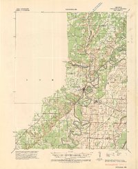
1941 Map of Strawberry
USGS Topo · Published 1946About this map
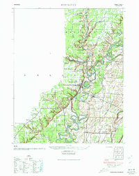
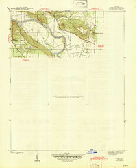
Strawberry and the surrounding rural communities of Lawrence, Sharp, and Independence Counties are captured here just before the mid-century. The landscape is defined by the winding course of the Strawberry River and the Black River, featuring a complex network of local schools and churches that served these upland and river-valley settlements. Notable social and infrastructure markers include the CCC Camp near Charlotte, indicating Depression-era public works projects, and the Pruitts Mill Site along a sharp bend in the river.
Find a feature on this map
58 named features on this map. Tap any name to fly to it.
Don’t see what you’re looking for? This feature index may not catch every label — zoom into the map to look around manually.
Map Details
Editions of this 1941 Strawberry Map
This is the sole edition of this map. No revisions or reprints were ever made.
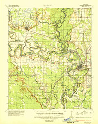
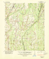
Other maps of this area

1890 · Batesville
USGS Topo · 1:125,000

1891 · Batesville
USGS Topo · 1:125,000

1932 · Strawberry
USGS Topo · 1:62,500
1934 · Powhatan
USGS Topo · 1:62,500
1935 · Powhatan
USGS Topo · 1:62,500

1935 · Alicia
USGS Topo · 1:62,500

1935 · Strawberry
USGS Topo · 1:62,500
1935 · Newport
USGS Topo · 1:62,500
1935 · Tuckerman
USGS Topo · 1:62,500
1942 · Salado
USGS Topo · 1:31,680