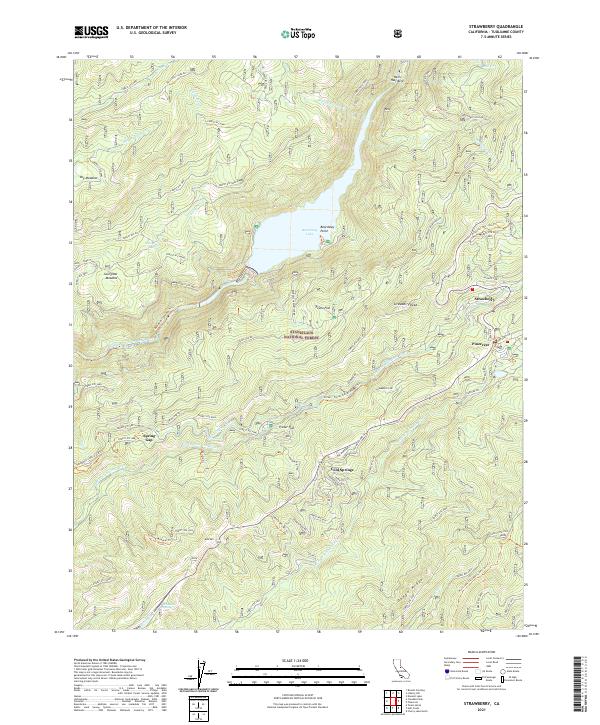
2021 Map of Strawberry
USGS Topo · Published 2021About this map
The Middle Fork Stanislaus River and its sister forks dominate this high-country landscape in the Stanislaus National Forest. At this elevation, the forest is defined by clearings like Sourgrass Meadow and prominent rises such as Bald Mtn and Strawberry Peak. Settlement is concentrated along the arterial corridor that includes Strawberry, Pinecrest, and Cold Springs, areas long valued for their proximity to alpine recreation and timber resources.
Find a feature on this map
61 named features on this map. Tap any name to fly to it.
Don’t see what you’re looking for? This feature index may not catch every label — zoom into the map to look around manually.
Map Details
Editions of this 2021 Strawberry Map
This is the sole edition of this map. No revisions or reprints were ever made.
Other maps of this area

1891 · Big Trees
USGS Topo · 1:125,000

1894 · Big Trees
USGS Topo · 1:125,000

1896 · Dardanelles
USGS Topo · 1:125,000

1897 · Big Trees
USGS Topo · 1:125,000

1898 · Dardanelles
USGS Topo · 1:125,000

1901 · Big Trees
USGS Topo · 1:125,000

1947 · Sacramento
USGS Topo · 1:250,000

1948 · Walker Lake
USGS Topo · 1:250,000

1948 · Sacramento
USGS Topo · 1:250,000

1956 · Sacramento
USGS Topo · 1:250,000