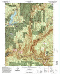
1994 Map of Strawberry Valley
USGS Topo · Published 1998About this map
Mooreville Ridge and Harrison Ridge dominate this rugged section of the Northern Sierra, where the boundaries of Plumas, Butte, Yuba, and Sierra counties converge. The landscape is defined by the legacy of hydraulic and hard-rock mining, with sites like Eureka Diggings, the Palace Mine, and the North Star scattered across the drainages of the North Fork Yuba River and Slate Creek. Small settlements and historic campsites such as Strawberry Valley, Brandy City, and Lewis Flat Camps are situated along steep ravines and ridges once bustling with gold-era activity.
Find a feature on this map
60 named features on this map. Tap any name to fly to it.
Don’t see what you’re looking for? This feature index may not catch every label — zoom into the map to look around manually.
Map Details
Editions of this 1994 Strawberry Valley Map
This is the sole edition of this map. No revisions or reprints were ever made.
Other maps of this area

1888 · Smartsville
USGS Topo · 1:125,000

1888 · Bidwell Bar
USGS Topo · 1:125,000

1891 · Bidwell Bar
USGS Topo · 1:125,000

1891 · Downieville
USGS Topo · 1:125,000

1891 · Colfax
USGS Topo · 1:125,000

1891 · Smartsville
USGS Topo · 1:125,000

1892 · Smartsville
USGS Topo · 1:125,000

1892 · Colfax
USGS Topo · 1:125,000

1893 · Bidwell Bar
USGS Topo · 1:125,000

1893 · Downieville
USGS Topo · 1:125,000