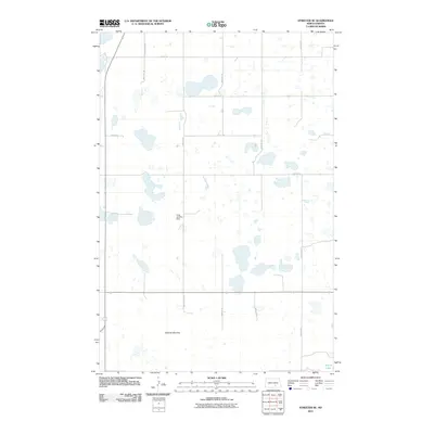
2011 Map of Streeter SE
USGS Topo · Published 2011About this map
Streeter Moraine dominates this portion of Logan County, shaping a landscape of numerous small potholes and basins typical of this glacial region in North Dakota. The terrain is characterized by a high density of water bodies, including School Lake in the southeast corner. The grid of rural roads is well-defined, with 55th ST Se and 55th Avenue Se providing the primary framework for local travel. A notable waypoint in this agrarian landscape is the Lang Landing Strip, located near the center of the quadrangle. The map reveals the intricate drainage and wetland patterns established by the moraine, showing how the natural topography dictates the layout of modern agriculture and transport in this prairie environment.
Find a feature on this map
15 named features on this map. Tap any name to fly to it.
Don’t see what you’re looking for? This feature index may not catch every label — zoom into the map to look around manually.
Map Details
Editions of this 2011 Streeter SE Map
This is the sole edition of this map. No revisions or reprints were ever made.
Other maps of this area

1953 · Jamestown
USGS Topo · 1:250,000

1956 · Jamestown
USGS Topo · 1:250,000

1982 · Fredonia NW
USGS Topo · 1:24,000

1982 · Lehr NW
USGS Topo · 1:24,000

1982 · Lehr NE
USGS Topo · 1:24,000

1983 · Streeter SW
USGS Topo · 1:24,000

1983 · Streeter
USGS Topo · 1:24,000

1983 · Gackle North
USGS Topo · 1:24,000

1983 · Streeter NW
USGS Topo · 1:24,000

1983 · Streeter SE
USGS Topo · 1:24,000