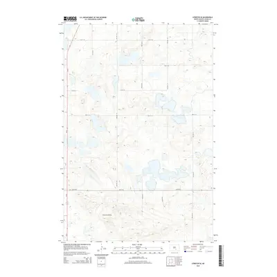
2014 Map of Streeter SE
USGS Topo · Published 2014About this map
Streeter Moraine dominates the southern reaches of this Logan County landscape, a prominent glacial landform that defines the local topography. This 2014 survey reveals a region defined by the prairie pothole ecosystem, where numerous unnamed wetlands and small water bodies dot the township-and-range grid. The most significant of these is School Lake, situated in the far southeastern corner. The area is intersected by a strictly orthogonal road network, including 61st St SE and 55th St SE, which facilitate travel through this largely agricultural and conservation-focused terrain. State highway Nd-30 provides the primary north-south corridor along the western edge, connecting the remote farmsteads and rural sections that characterize this part of the North Dakota plains.
Find a feature on this map
13 named features on this map. Tap any name to fly to it.
Don’t see what you’re looking for? This feature index may not catch every label — zoom into the map to look around manually.
Map Details
Editions of this 2014 Streeter SE Map
This is the sole edition of this map. No revisions or reprints were ever made.
Other maps of this area

1953 · Jamestown
USGS Topo · 1:250,000

1956 · Jamestown
USGS Topo · 1:250,000

1982 · Fredonia NW
USGS Topo · 1:24,000

1982 · Lehr NW
USGS Topo · 1:24,000

1982 · Lehr NE
USGS Topo · 1:24,000

1983 · Streeter SW
USGS Topo · 1:24,000

1983 · Streeter
USGS Topo · 1:24,000

1983 · Gackle North
USGS Topo · 1:24,000

1983 · Streeter NW
USGS Topo · 1:24,000

1983 · Streeter SE
USGS Topo · 1:24,000