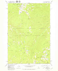
1979 Map of Stripe Mtn
USGS Topo · Published 1979About this map
Stripe Mountain rises as a central landmark in this high-elevation landscape, where the Idaho and Lemhi county line intersects with protected forest boundaries. The terrain is characterized by a dense network of ridges, including Dennis Ridge, Harrington Ridge, and Witter Ridge, which define the drainage basins for numerous high-altitude water bodies such as Swet Lake and the Hamilton Lakes. This area was managed as part of the Salmon River Breaks Primitive Area, reflecting a period of wilderness preservation within the Bitterroot National Forest.
Find a feature on this map
36 named features on this map. Tap any name to fly to it.
Don’t see what you’re looking for? This feature index may not catch every label — zoom into the map to look around manually.
Map Details
Editions of this 1979 Stripe Mtn Map
This is the sole edition of this map. No revisions or reprints were ever made.
Other maps of this area

1956 · Elk City
USGS Topo · 1:250,000

1960 · Elk City
USGS Topo · 1:250,000

1962 · Wood Hump
USGS Topo · 1:24,000

1962 · Beaver Jack Mtn
USGS Topo · 1:24,000

1962 · Square Top
USGS Topo · 1:24,000

1978 · Waugh Mountain
USGS Topo · 1:24,000

1978 · Dennis Mtn
USGS Topo · 1:24,000

1978 · Magruder Mtn
USGS Topo · 1:24,000

1978 · Devils Teeth Rapids
USGS Topo · 1:24,000
1979 · Sabe Mtn
USGS Topo · 1:24,000