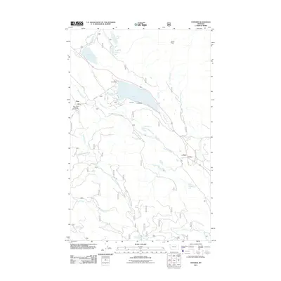
2011 Map of Stryker
USGS Topo · Published 2011About this map
Trego and Stryker serve as the primary hubs in this corner of Lincoln County, Montana, situated along a corridor defined by the Stillwater River and the local mountain topography. The presence of the Trego Post Office and Stryker Post Office highlights these small communities as enduring points of local commerce and communication. The landscape is characterized by a dense network of water bodies, including Dickey Lake and Murphy Lake, which are accompanied by the North Campground and South Campground, suggesting the area's significance for regional recreation.
Find a feature on this map
35 named features on this map. Tap any name to fly to it.
Don’t see what you’re looking for? This feature index may not catch every label — zoom into the map to look around manually.
Map Details
Editions of this 2011 Stryker Map
This is the sole edition of this map. No revisions or reprints were ever made.
Other maps of this area

1913 · Stryker
USGS Topo · 1:125,000

1916 · Stryker
USGS Topo · 1:125,000

1957 · Kalispell
USGS Topo · 1:250,000

1960 · Kalispell
USGS Topo · 1:250,000

1961 · Kalispell
USGS Topo · 1:250,000

1963 · Mount Marston
USGS Topo · 1:24,000

1963 · Stryker
USGS Topo · 1:24,000
1963 · Skillet Mountain
USGS Topo · 1:24,000

1963 · Sunday Mountain
USGS Topo · 1:24,000
1963 · Edna Mountain
USGS Topo · 1:24,000