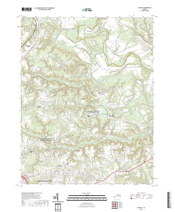
2022 Map of Studley
USGS Topo · Published 2022About this map
Richmond National Battlefield Park anchors the landscape of central Hanover County, marking the ground where the American Civil War shaped the region’s topography. The area around Studley and Buckeye is deeply rooted in local genealogy, evidenced by numerous family and community burial grounds such as Atkins Melton and Tate Cem and the Second Union Cem. The northern reach of the survey is defined by the winding course of the Pamunkey River and the agricultural peninsulas of Sutton Neck and Crump Neck. This modern mapping captures the expansion of Mechanicsville to the south, where suburban developments like Colonial Forest meet the historic drainages of Totopotomoy Cr and Matadequin Cr. The persistence of these watercourses and small settlements provides a clear record of the rural-to-suburban transition occurring just north of Richmond.
Find a feature on this map
183 named features on this map. Tap any name to fly to it.
Don’t see what you’re looking for? This feature index may not catch every label — zoom into the map to look around manually.
Map Details
Editions of this 2022 Studley Map
This is the sole edition of this map. No revisions or reprints were ever made.
Other maps of this area

1894 · Richmond
USGS Topo · 1:62,500

1895 · Richmond
USGS Topo · 1:62,500

1918 · Doswell
USGS Topo · 1:62,500

1918 · Aylett
USGS Topo · 1:62,500

1920 · King William
USGS Topo · 1:62,500

1933 · Aylett
USGS Topo · 1:62,500

1934 · Seven Pines
USGS Topo · 1:24,000

1934 · Richmond
USGS Topo · 1:24,000

1938 · Seven Pines
USGS Topo · 1:31,680

1938 · Studley
USGS Topo · 1:31,680