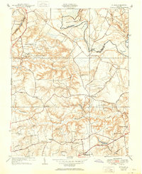
1951 Map of Studley
USGS Topo · Published 1951About this map
The Pamunkey River winds along the eastern boundary of this Hanover County landscape, where the meandering water creates distinct geographic features like Sutton Neck and Crump Neck. This 1951 revision reveals a rural community structured around small crossroads settlements and an extensive network of country churches and schools. The Chesapeake and Ohio railroad cuts through the northwestern corner near Cady, while the southern portion of the map is anchored by the Battlefield Park High Sch and the community of Pole Green. Genealogists and local historians will find numerous landmarks of interest, including several educational sites like the Industrial Sch and Pole Green Sch, and religious centers such as New Bethesda Ch and Enon Ch. The terrain is deeply dissected by tributaries like Totopotomoy Creek and Crump Creek, illustrating the natural drainage patterns that shaped local development and road placement.
Find a feature on this map
54 named features on this map. Tap any name to fly to it.
Don’t see what you’re looking for? This feature index may not catch every label — zoom into the map to look around manually.
Map Details
Editions of this 1951 Studley Map
This is the sole edition of this map. No revisions or reprints were ever made.
Other maps of this area

1894 · Richmond
USGS Topo · 1:62,500

1895 · Richmond
USGS Topo · 1:62,500

1918 · Doswell
USGS Topo · 1:62,500

1918 · Aylett
USGS Topo · 1:62,500

1920 · King William
USGS Topo · 1:62,500

1933 · Aylett
USGS Topo · 1:62,500

1934 · Seven Pines
USGS Topo · 1:24,000

1934 · Richmond
USGS Topo · 1:24,000

1938 · Seven Pines
USGS Topo · 1:31,680

1938 · Studley
USGS Topo · 1:31,680