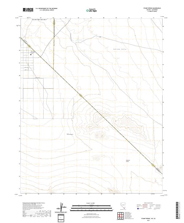
2021 Map of Stump Spring
USGS Topo · Published 2021About this map
The Old Spanish Trail Hwy cuts diagonally across this desert landscape, tracing a historic path through the Pahrump Valley and Mesquite Valley. This modern survey records the precise intersection of the Mojave Desert with the state line where Nevada meets California. In the northwestern corner, a small cluster of residential roads including Charleston Ln and Mabel Ln marks a pocket of development near the Saint Therese Mission Cem Grounds. The namesake Stump Spring is positioned in the northern reaches, a vital water source in an otherwise arid expanse defined by the transition between the Nye, Clark, and Inyo county boundaries.
Find a feature on this map
13 named features on this map. Tap any name to fly to it.
Don’t see what you’re looking for? This feature index may not catch every label — zoom into the map to look around manually.
Map Details
Editions of this 2021 Stump Spring Map
This is the sole edition of this map. No revisions or reprints were ever made.
Other maps of this area

1907 · Las Vegas
USGS Topo · 1:250,000

1908 · Las Vegas
USGS Topo · 1:250,000

1910 · Ivanpah
USGS Topo · 1:250,000

1912 · Ivanpah
USGS Topo · 1:250,000

1942 · Ivanpah
USGS Topo · 1:250,000

1947 · Kingman
USGS Topo · 1:250,000

1948 · Kingman
USGS Topo · 1:250,000

1954 · Las Vegas
USGS Topo · 1:250,000

1954 · Kingman
USGS Topo · 1:250,000

1955 · Kingman
USGS Topo · 1:250,000