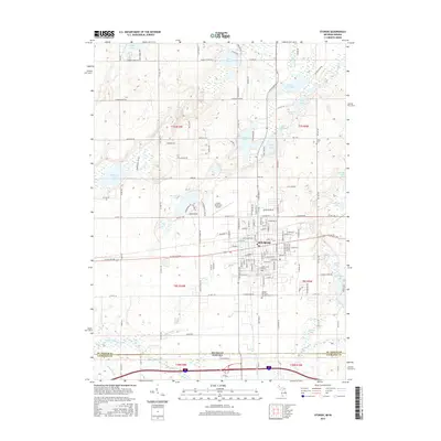
2017 Map of Sturgis
USGS Topo · Published 2017About this map
The city of Sturgis anchors this southern Michigan landscape, situated just north of the Indiana border. The area is defined by a dense concentration of glacial lakes and complex drainage patterns, including the Prairie River to the north and the Fawn River to the south. Notable water bodies such as Minnewaukan Lake, Perrin Lake, and Eight Foot Lake are interspersed with smaller features like Nye Drain and Wenger Ditch. Aviation history is represented by the Kirsch Municipal Airport, which sits on the northwestern edge of the city. The township grid is well-established, with roads like Featherstone Rd and Mintdale Rd connecting the rural lakefronts. Local genealogical interest is found in several burial grounds, including the large Oak Lawn Cem and the outlying Tobey Cem, providing a detailed view of the community's footprint in the late 2010s.
Find a feature on this map
135 named features on this map. Tap any name to fly to it.
Don’t see what you’re looking for? This feature index may not catch every label — zoom into the map to look around manually.
Map Details
Editions of this 2017 Sturgis Map
This is the sole edition of this map. No revisions or reprints were ever made.
Other maps of this area

1914 · Three Rivers
USGS Topo · 1:62,500

1916 · Three Rivers
USGS Topo · 1:62,500

1943 · Three Rivers
USGS Topo · 1:62,500

1947 · Mongo
USGS Topo · 1:24,000

1947 · Lagrange
USGS Topo · 1:24,000

1953 · Fort Wayne
USGS Topo · 1:250,000

1956 · Fort Wayne
USGS Topo · 1:250,000
1960 · Lagrange
USGS Topo · 1:24,000
1960 · Mongo
USGS Topo · 1:24,000
1961 · Sturgis
USGS Topo · 1:24,000