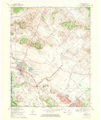
1969 Map of Sturgis
USGS Topo · Published 1971About this map
Sturgis serves as a focal point of commerce and transit in western Kentucky, where the Illinois Central Railroad and several prominent roads converge. The landscape is defined by its agricultural and industrial character, featuring the Sturgis Airport and a large Strip Mine near the Union and Webster County line. Local community life is deeply etched into the topography through a high density of rural institutions, such as Wallace School and numerous house of worship and burial grounds including Bethany Ch, Salem Cem, and Pythian Ridge Cem. The transition from the developed town to the surrounding hills is marked by landmarks like Blueberry Hill and the Fairgrounds. The presence of several Oil Wells and an extensive network of drainage features like Corbett Ditch reflect a land heavily managed for both extraction and cultivation.
Find a feature on this map
55 named features on this map. Tap any name to fly to it.
Don’t see what you’re looking for? This feature index may not catch every label — zoom into the map to look around manually.
Map Details
Editions of this 1969 Sturgis Map
2 editions found
Other maps of this area

1907 · Morganfield
USGS Topo · 1:62,500

1909 · Providence
USGS Topo · 1:62,500

1916 · Shawneetown
USGS Topo · 1:62,500

1916 · Fords Ferry
USGS Topo · 1:62,500

1921 · Fords Ferry
USGS Topo · 1:48,000

1925 · Cave In Rock
USGS Topo · 1:62,500

1949 · Paducah
USGS Topo · 1:250,000

1949 · Morganfield
USGS Topo · 1:24,000

1950 · Paducah
USGS Topo · 1:250,000

1951 · Waverly
USGS Topo · 1:24,000