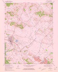
1969 Map of Sturgis
USGS Topo · Published 1970About this map
The city of Sturgis serves as the focal point of this Union County landscape, where the confluence of agriculture, aviation, and extraction industries is evident. The western portion of the sheet is dominated by the Sturgis Airport and the local Fairgrounds, set against a backdrop of rolling terrain including Blueberry Hill and Pythian Ridge. The rural character is defined by a dense network of family-named roads such as O'Nan Road and Holeman Road, connecting historic community centers like Mt Gilead Ch and Bethany Ch.
Find a feature on this map
65 named features on this map. Tap any name to fly to it.
Don’t see what you’re looking for? This feature index may not catch every label — zoom into the map to look around manually.
Map Details
Editions of this 1969 Sturgis Map
2 editions found
Other maps of this area

1907 · Morganfield
USGS Topo · 1:62,500

1909 · Providence
USGS Topo · 1:62,500

1916 · Shawneetown
USGS Topo · 1:62,500

1916 · Fords Ferry
USGS Topo · 1:62,500

1921 · Fords Ferry
USGS Topo · 1:48,000

1925 · Cave In Rock
USGS Topo · 1:62,500

1949 · Paducah
USGS Topo · 1:250,000

1949 · Morganfield
USGS Topo · 1:24,000

1950 · Paducah
USGS Topo · 1:250,000

1951 · Waverly
USGS Topo · 1:24,000