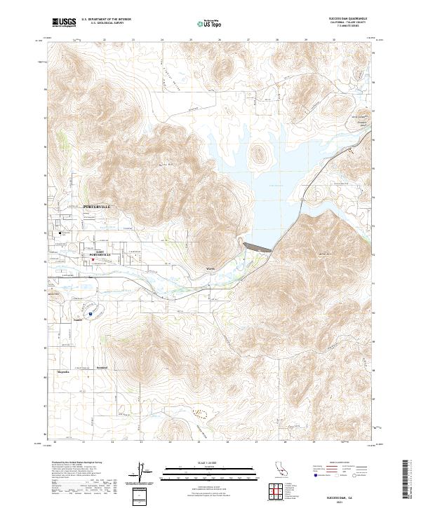
2021 Map of Success Dam
USGS Topo · Published 2021About this map
Lake Success and the Tule River dominate this Central Valley landscape, where complex irrigation systems define the agricultural and residential development of Tulare County. The intricate network of water management, including the Pioneer Ditch, Porter Slough, and Campbell-Moreland Ditch, highlights the region's reliance on water engineering to support growing communities like Porterville and East Porterville. The terrain transitions from the developed streets of Magnolia and Sunland toward the rising elevations of Rocky Hill and Mine Hill to the east.
Find a feature on this map
57 named features on this map. Tap any name to fly to it.
Don’t see what you’re looking for? This feature index may not catch every label — zoom into the map to look around manually.
Map Details
Editions of this 2021 Success Dam Map
This is the sole edition of this map. No revisions or reprints were ever made.
Other maps of this area

1904 · Kaweah
USGS Topo · 1:125,000

1909 · Kaweah
USGS Topo · 1:125,000

1928 · Lindsay
USGS Topo · 1:31,680

1929 · Porterville
USGS Topo · 1:31,680

1929 · Ducor
USGS Topo · 1:31,680

1936 · White River
USGS Topo · 1:62,500

1936 · Tobias Peak
USGS Topo · 1:125,000

1937 · Kaweah
USGS Topo · 1:125,000
1942 · Porterville
USGS Topo · 1:62,500
1942 · Terra Bella
USGS Topo · 1:62,500