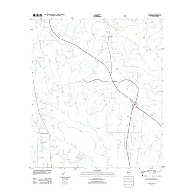
2012 Map of Success
USGS Topo · Published 2012About this map
Success serves as a central point in this part of Harrison County, where the landscape is defined by the complex drainage systems of the Biloxi River and the Little Biloxi River. The area maintains a mix of traditional land uses and modern development, with the Lyman Fish Hatchery and the Harrison Lookout Tower indicating a landscape managed for both natural resources and conservation. The rural character of the region is preserved through numerous family and community burial grounds, such as Rouse Cem, Saucier Cem, and Blackwell Cem, which provide valuable touchstones for local genealogists. Recreation and infrastructure are represented by the Grand Bear Golf Course and the Little Biloxi River Bridge, showing how the timber-rich terrain north of Gulfport has evolved into a corridor for residential growth and outdoor leisure while still retaining its many creeks and branches, including Palmer Cr and Tiger Cr.
Find a feature on this map
95 named features on this map. Tap any name to fly to it.
Don’t see what you’re looking for? This feature index may not catch every label — zoom into the map to look around manually.
Map Details
Editions of this 2012 Success Map
This is the sole edition of this map. No revisions or reprints were ever made.
Other maps of this area

1953 · Mobile
USGS Topo · 1:250,000

1954 · Vestry
USGS Topo · 1:62,500

1954 · McHenry
USGS Topo · 1:62,500

1954 · Gulfport North
USGS Topo · 1:24,000

1954 · Biloxi
USGS Topo · 1:24,000

1954 · Biloxi
USGS Topo · 1:62,500

1956 · Gulfport NW
USGS Topo · 1:24,000

1957 · Mobile
USGS Topo · 1:250,000

1960 · Mobile
USGS Topo · 1:250,000

1963 · Mobile
USGS Topo · 1:250,000