2021 Map of Success
USGS Topo · Published 2021About this map
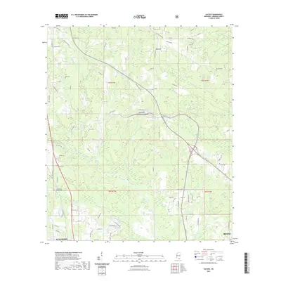
The unincorporated community of Success serves as a focal point within this modern survey of Harrison County, situated on the northern edge of the De Soto National Forest. The landscape is defined by the dense drainage network of the Biloxi River and Little Biloxi River, with numerous small tributaries like Saucier Creek and Beaver Dam Br cutting through the forested terrain. This map provides critical documentation for genealogists, as it preserves the locations of several family and community burial grounds, including Rouse Cem, Blackwell Cem, Saucier Cem, Midway Cem, and Williams Cem. The transition from the rural northern reaches to the urban fringes of Gulfport and Biloxi in the south is evident, following the path of major thoroughfares such as Tradition Pkwy and the Little Biloxi River Bridge.
Find a feature on this map
94 named features on this map. Tap any name to fly to it.
Don’t see what you’re looking for? This feature index may not catch every label — zoom into the map to look around manually.
Map Details
Editions of this 2021 Success Map
This is the sole edition of this map. No revisions or reprints were ever made.
Other maps of this area

1953 · Mobile
USGS Topo · 1:250,000

1954 · Vestry
USGS Topo · 1:62,500

1954 · McHenry
USGS Topo · 1:62,500

1954 · Gulfport North
USGS Topo · 1:24,000

1954 · Biloxi
USGS Topo · 1:24,000

1954 · Biloxi
USGS Topo · 1:62,500

1956 · Gulfport NW
USGS Topo · 1:24,000

1957 · Mobile
USGS Topo · 1:250,000

1960 · Mobile
USGS Topo · 1:250,000

1963 · Mobile
USGS Topo · 1:250,000