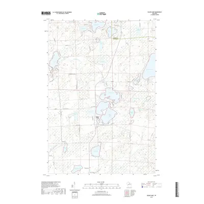
2018 Map of Sugar Camp
USGS Topo · Published 2018About this map
Sugar Camp serves as the focal point of this northern Wisconsin landscape, situated amidst a dense network of glacial lakes and wetlands. The topography is defined by significant water bodies such as Sugar Camp Lake, Indian Lake, and Columbus Lake, which are connected by a web of small streams including Kathan Cr and Indian Chain Cr. The map reveals a transition from the water-dominated terrain of the northern lakes like Arbutus Lake and Aldridge Lake to the more forested and wetland-rich areas surrounding Tamarack Lake and Lost Lake in the south.
Find a feature on this map
76 named features on this map. Tap any name to fly to it.
Don’t see what you’re looking for? This feature index may not catch every label — zoom into the map to look around manually.
Map Details
Editions of this 2018 Sugar Camp Map
This is the sole edition of this map. No revisions or reprints were ever made.
Other maps of this area

1928 · Three Lakes
USGS Topo · 1:48,000

1930 · Robbins
USGS Topo · 1:48,000

1938 · Three Lakes
USGS Topo · 1:48,000

1938 · Robbins
USGS Topo · 1:48,000

1940 · Monico
USGS Topo · 1:48,000

1940 · Rhinelander
USGS Topo · 1:48,000

1945 · Three Lakes
USGS Topo · 1:48,000

1945 · Robbins
USGS Topo · 1:48,000

1949 · Rhinelander
USGS Topo · 1:48,000

1950 · Monico
USGS Topo · 1:48,000