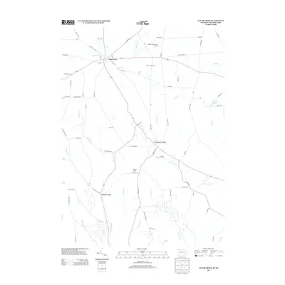
2013 Map of Sugar Grove
USGS Topo · Published 2013About this map
Sugar Grove anchors the landscape at the northern edge of this Pennsylvania-New York border survey, where the Stillwater Cr meanders through a valley defined by rural intersections and small-scale industry. The presence of the Sugar Grove Oil Field east of the village indicates the area's continued connection to local resource extraction, while the Sanders Personal Use Airport and Jackson Valley Golf Course suggest a shift toward recreational land use in the early 21st century.
Find a feature on this map
79 named features on this map. Tap any name to fly to it.
Don’t see what you’re looking for? This feature index may not catch every label — zoom into the map to look around manually.
Map Details
Editions of this 2013 Sugar Grove Map
This is the sole edition of this map. No revisions or reprints were ever made.
Other maps of this area

1904 · Chautaqua
USGS Topo · 1:62,500

1905 · Jamestown
USGS Topo · 1:62,500

1906 · Warren
USGS Topo · 1:62,500

1907 · Warren
USGS Topo · 1:62,500

1908 · Warren
USGS Topo · 1:62,500

1926 · Youngsville
USGS Topo · 1:62,500

1929 · Youngsville
USGS Topo · 1:62,500

1941 · Chautauqua
USGS Topo · 1:62,500

1942 · Jamestown
USGS Topo · 1:62,500

1943 · Youngsville
USGS Topo · 1:62,500