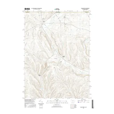
2016 Map of Sugar Grove
USGS Topo · Published 2016About this map
The borderlands between Chautauqua County, New York, and Warren County, Pennsylvania, are defined by a complex network of narrow valley runs and high ridges. Sugar Grove serves as a primary local hub, positioned near the headwaters of Stillwater Cr, while the settlement of Chandlers Valley sits to the southeast along the banks of Jackson Run. The topography is marked by significant elevation changes, ranging from the heights of Brown Hill and Goast Hill down to the low-lying Sugar Grove Swamp.
Find a feature on this map
69 named features on this map. Tap any name to fly to it.
Don’t see what you’re looking for? This feature index may not catch every label — zoom into the map to look around manually.
Map Details
Editions of this 2016 Sugar Grove Map
This is the sole edition of this map. No revisions or reprints were ever made.
Other maps of this area

1904 · Chautaqua
USGS Topo · 1:62,500

1905 · Jamestown
USGS Topo · 1:62,500

1906 · Warren
USGS Topo · 1:62,500

1907 · Warren
USGS Topo · 1:62,500

1908 · Warren
USGS Topo · 1:62,500

1926 · Youngsville
USGS Topo · 1:62,500

1929 · Youngsville
USGS Topo · 1:62,500

1941 · Chautauqua
USGS Topo · 1:62,500

1942 · Jamestown
USGS Topo · 1:62,500

1943 · Youngsville
USGS Topo · 1:62,500