2023 Map of Sugar Grove
USGS Topo · Published 2023About this map
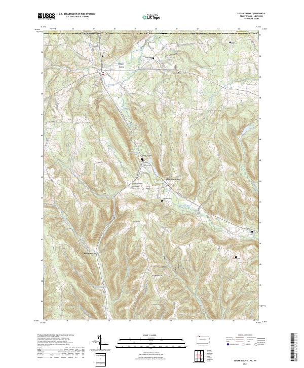
Sugar Grove sits at the intersection of local history and the New York state line, serving as a gateway to the valleys of northern Warren County. This landscape is defined by its deep spiritual and communal roots, evidenced by numerous burial grounds such as the Swedish Methodist Episcopalian Church Cem and the Hessel Valley Lutheran Cem near Chandlers Valley. The terrain is characterized by winding watercourses like Stillwater Creek and Jackson Run that carve through the hills. A unique local landmark, the Robert Miles Gravesite, stands alongside more modern additions like the Sanders Personal Use Airport. The presence of the Sugar Grove Swamp and the named heights of Goast Hill and Brown Hill illustrate a rural geography where family names are etched into the roads and ridges, maintaining a settlement pattern that has persisted for generations.
Find a feature on this map
71 named features on this map. Tap any name to fly to it.
Don’t see what you’re looking for? This feature index may not catch every label — zoom into the map to look around manually.
Map Details
Editions of this 2023 Sugar Grove Map
This is the sole edition of this map. No revisions or reprints were ever made.