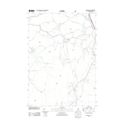
2012 Map of Sugar Hill
USGS Topo · Published 2012About this map
Sugar Hill sits at the heart of this White Mountains landscape, where the terrain transitions from the Ammonoosuc River valley in the northwest to the higher elevations of Bald Peak in the southeast. The settlement pattern is defined by high-elevation hamlets and scattered farms, connected by a network of winding roads like Oregon Rd and Gilman Hill Rd. Water resources are abundant, with Salmon Hole Brook, Mill Brook, and Scotland Brook draining the central hills toward the larger Ammonoosuc River.
Find a feature on this map
92 named features on this map. Tap any name to fly to it.
Don’t see what you’re looking for? This feature index may not catch every label — zoom into the map to look around manually.
Map Details
Editions of this 2012 Sugar Hill Map
This is the sole edition of this map. No revisions or reprints were ever made.
Other maps of this area

1900 · Whitefield
USGS Topo · 1:62,500

1929 · Moosilauke
USGS Topo · 1:62,500

1929 · Franconia
USGS Topo · 1:62,500

1931 · Littleton
USGS Topo · 1:62,500

1932 · Franconia
USGS Topo · 1:62,500

1932 · Littleton
USGS Topo · 1:48,000

1932 · Moosilauke
USGS Topo · 1:62,500

1935 · Littleton
USGS Topo · 1:62,500

1935 · Whitefield
USGS Topo · 1:48,000

1938 · Whitefield
USGS Topo · 1:62,500