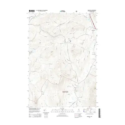
2015 Map of Sugar Hill
USGS Topo · Published 2015About this map
Sugar Hill and Franconia anchor this 2015 topographic study of the western White Mountains, where the village centers give way to the protected highlands of the White Mountain National Forest. The landscape is defined by the narrow valleys of the Ammonoosuc River and Gale River, with local transport infrastructure such as the Ammonoosuc Rail Trl reflecting the region's shift toward recreation. Notable peaks like Northey Hill, Bronson Hill, and Bald Peak rise sharply above small settlements like Easton and the locality of Jericho. Cultural landmarks, including Sunny Side Cem, Willow Cem, and the Franconia Airport, provide a detailed view of the community's footprint. The prevalence of named brooks, including Salmon Hole Brook and Coppermine Brook, underscores a complex drainage system that has historically shaped the agricultural and industrial potential of these New Hampshire valleys.
Find a feature on this map
105 named features on this map. Tap any name to fly to it.
Don’t see what you’re looking for? This feature index may not catch every label — zoom into the map to look around manually.
Map Details
Editions of this 2015 Sugar Hill Map
This is the sole edition of this map. No revisions or reprints were ever made.
Other maps of this area

1900 · Whitefield
USGS Topo · 1:62,500

1929 · Moosilauke
USGS Topo · 1:62,500

1929 · Franconia
USGS Topo · 1:62,500

1931 · Littleton
USGS Topo · 1:62,500

1932 · Franconia
USGS Topo · 1:62,500

1932 · Littleton
USGS Topo · 1:48,000

1932 · Moosilauke
USGS Topo · 1:62,500

1935 · Littleton
USGS Topo · 1:62,500

1935 · Whitefield
USGS Topo · 1:48,000

1938 · Whitefield
USGS Topo · 1:62,500