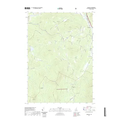
2021 Map of Sugar Hill
USGS Topo · Published 2021About this map
Sugar Hill and Franconia serve as the primary nodes of settlement in this northern New Hampshire landscape, where the transition from river valleys to high peaks is sharply defined. The Ammonoosuc River and Salmon Hole Brook carve through the northern terrain, while the southern reaches are dominated by the White Mountain National Forest. High points such as Northey Hill, Bronson Hill, and Ore Hill overlook a network of rural roads that connect small communities like Easton and the locality of Jericho. Local history and genealogy are preserved in sites like Sunny Side Cem and Kinsman Cem, while the Franconia Airport reflects the area's modern infrastructure. The map illustrates a classic New England pattern of concentrated villages amidst expansive timberlands and mountain ridges.
Find a feature on this map
91 named features on this map. Tap any name to fly to it.
Don’t see what you’re looking for? This feature index may not catch every label — zoom into the map to look around manually.
Map Details
Editions of this 2021 Sugar Hill Map
This is the sole edition of this map. No revisions or reprints were ever made.
Other maps of this area

1900 · Whitefield
USGS Topo · 1:62,500

1929 · Moosilauke
USGS Topo · 1:62,500

1929 · Franconia
USGS Topo · 1:62,500

1931 · Littleton
USGS Topo · 1:62,500

1932 · Franconia
USGS Topo · 1:62,500

1932 · Littleton
USGS Topo · 1:48,000

1932 · Moosilauke
USGS Topo · 1:62,500

1935 · Littleton
USGS Topo · 1:62,500

1935 · Whitefield
USGS Topo · 1:48,000

1938 · Whitefield
USGS Topo · 1:62,500