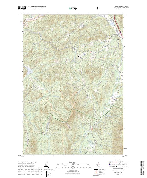
2024 Map of Sugar Hill
USGS Topo · Published 2024About this map
Franconia and Easton serve as the primary residential anchors in this part of the White Mountains, where the landscape is defined by a dense network of hills and descending brooks. The topography is dominated by peaks like Bronson Hill and Northey Hill, while the drainage of the Ham Branch and Salmon Hole Brook dictates the path of local travel. For those tracing local families, the map includes Sunny Side Cem, Willow Cem, and Kinsman Cem, providing vital clues for genealogical research in these small communities.
Find a feature on this map
96 named features on this map. Tap any name to fly to it.
Don’t see what you’re looking for? This feature index may not catch every label — zoom into the map to look around manually.
Map Details
Editions of this 2024 Sugar Hill Map
This is the sole edition of this map. No revisions or reprints were ever made.
Other maps of this area

1900 · Whitefield
USGS Topo · 1:62,500

1929 · Moosilauke
USGS Topo · 1:62,500

1929 · Franconia
USGS Topo · 1:62,500

1931 · Littleton
USGS Topo · 1:62,500

1932 · Franconia
USGS Topo · 1:62,500

1932 · Littleton
USGS Topo · 1:48,000

1932 · Moosilauke
USGS Topo · 1:62,500

1935 · Littleton
USGS Topo · 1:62,500

1935 · Whitefield
USGS Topo · 1:48,000

1938 · Whitefield
USGS Topo · 1:62,500