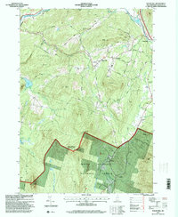
1995 Map of Sugar Hill
USGS Topo · Published 2000About this map
Sugar Hill and its surrounding uplands are defined by a complex network of ridgelines and brooks that flow toward the Ammonoosuc River in the north and west. In the late 20th century, the landscape shows a clear division between the more developed residential and recreational areas, such as the Golf Course and St Matthews Church near the town center, and the preserved wilderness of the White Mountain National Forest to the south.
Find a feature on this map
57 named features on this map. Tap any name to fly to it.
Don’t see what you’re looking for? This feature index may not catch every label — zoom into the map to look around manually.
Map Details
Editions of this 1995 Sugar Hill Map
This is the sole edition of this map. No revisions or reprints were ever made.
Other maps of this area

1900 · Whitefield
USGS Topo · 1:62,500

1929 · Moosilauke
USGS Topo · 1:62,500

1929 · Franconia
USGS Topo · 1:62,500

1931 · Littleton
USGS Topo · 1:62,500

1932 · Franconia
USGS Topo · 1:62,500

1932 · Littleton
USGS Topo · 1:48,000

1932 · Moosilauke
USGS Topo · 1:62,500

1935 · Littleton
USGS Topo · 1:62,500

1935 · Whitefield
USGS Topo · 1:48,000

1938 · Whitefield
USGS Topo · 1:62,500