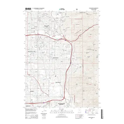
2014 Map of Sugar House
USGS Topo · Published 2014About this map
Sugar House serves as a historic urban hub where the developed streets of the Salt Lake Valley meet the rising slopes of the Wasatch Range. This 2014 record shows a mature suburban and commercial landscape, including Westminster Coll and the Wheeler Historic Farm, illustrating the transition from early agricultural roots to modern educational and residential sectors. The eastern edge of the map is dominated by the steep, dramatic topography of the Wasatch National Forest, where canyons such as Emigration Canyon and Parleys Canyon provide natural corridors into the mountains.
Find a feature on this map
76 named features on this map. Tap any name to fly to it.
Don’t see what you’re looking for? This feature index may not catch every label — zoom into the map to look around manually.
Map Details
Editions of this 2014 Sugar House Map
This is the sole edition of this map. No revisions or reprints were ever made.
Other maps of this area

1885 · Salt Lake
USGS Topo · 1:250,000

1925 · Ft. Douglas
USGS Topo · 1:125,000

1928 · Ft. Douglas
USGS Topo · 1:125,000

1950 · Fort Douglas
USGS Topo · 1:24,000

1951 · Fort Douglas
USGS Topo · 1:24,000

1951 · Salt Lake City South
USGS Topo · 1:24,000

1951 · Midvale
USGS Topo · 1:24,000

1951 · Salt Lake City North
USGS Topo · 1:24,000

1952 · Sugar House
USGS Topo · 1:24,000
1952 · Draper
USGS Topo · 1:24,000