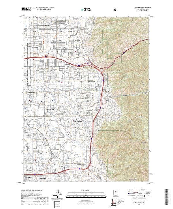
2023 Map of Sugar House
USGS Topo · Published 2023About this map
The eastern benches of the Salt Lake Valley are defined here by the meeting of established suburban neighborhoods and the steep ascent of the Wasatch Range. This modern survey details the transition from the historic grid of Salt Lake City and Sugar House into the canyon-adjacent communities of Millcreek, Holladay, and East Millcreek. A sophisticated water management infrastructure is visible, tracing the Salt Lake City Aqueduct and several historic irrigation routes like the Jordan and Salt Lake City Canal and the East Jordan Canal.
Find a feature on this map
71 named features on this map. Tap any name to fly to it.
Don’t see what you’re looking for? This feature index may not catch every label — zoom into the map to look around manually.
Map Details
Editions of this 2023 Sugar House Map
This is the sole edition of this map. No revisions or reprints were ever made.
Other maps of this area

1885 · Salt Lake
USGS Topo · 1:250,000

1925 · Ft. Douglas
USGS Topo · 1:125,000

1928 · Ft. Douglas
USGS Topo · 1:125,000

1950 · Fort Douglas
USGS Topo · 1:24,000

1951 · Fort Douglas
USGS Topo · 1:24,000

1951 · Salt Lake City South
USGS Topo · 1:24,000

1951 · Midvale
USGS Topo · 1:24,000

1951 · Salt Lake City North
USGS Topo · 1:24,000

1952 · Sugar House
USGS Topo · 1:24,000
1952 · Draper
USGS Topo · 1:24,000