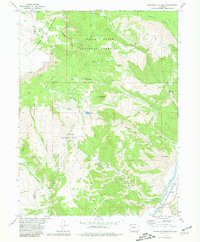
1977 Map of Sugarloaf Mountain
USGS Topo · Published 1981About this map
White River National Forest and the Flat Tops Mountain Wilderness dominate this high-elevation landscape on the border of Garfield and Eagle counties. The topography is defined by significant peaks like Sugarloaf Mountain and Porphyry Mountain, giving way to the Derby Mesa in the northeast. Water management and wildlife conservation are central to the area's character, evidenced by the expansive Dotsero Wildlife Area (State) and numerous high-country water sources such as Willow Lake and Horse Lake.
Find a feature on this map
33 named features on this map. Tap any name to fly to it.
Don’t see what you’re looking for? This feature index may not catch every label — zoom into the map to look around manually.
Map Details
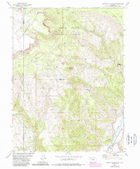
Editions of this 1977 Sugarloaf Mountain Map
2 editions found
Other maps of this area

1927 · Glenwood Springs
USGS Topo · 1:125,000

1930 · Glenwood Springs
USGS Topo · 1:125,000

1957 · Leadville
USGS Topo · 1:250,000

1959 · Leadville
USGS Topo · 1:250,000

1960 · Leadville
USGS Topo · 1:250,000

1962 · Leadville
USGS Topo · 1:250,000

1962 · Gypsum
USGS Topo · 1:24,000

1964 · Leadville
USGS Topo · 1:250,000
1972 · Burns South
USGS Topo · 1:24,000
1972 · Burns North
USGS Topo · 1:24,000