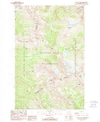
1988 Map of Suiattle Pass
USGS Topo · Published 1988About this map
Glacier Peak Wilderness dominates this high-altitude landscape along the divide between Snohomish and Chelan counties. The 1988 survey documents a region defined by ice and extreme elevation, centered on the Lyman Glacier and the headwaters of the Chiwawa River and Railroad Creek. The presence of the Glacier Peak Mines on the eastern slopes of Miners Ridge points to the area's history of mineral exploration despite the difficult terrain. High-altitude routes are clearly delineated, including the Pacific Crest National Scenic Trail as it traverses Suiattle Pass and winds toward Cloudy Pass. The map serves as a record of glacial extents in the late 20th century, showing several named permanent ice fields such as Grant Glacier, Company Glacier, and Spider Glacier flanking massive summits like Bonanza Peak and North Star Mtn.
Find a feature on this map
41 named features on this map. Tap any name to fly to it.
Don’t see what you’re looking for? This feature index may not catch every label — zoom into the map to look around manually.
Map Details
Editions of this 1988 Suiattle Pass Map
2 editions found
Other maps of this area

1899 · Glacier Peak
USGS Topo · 1:125,000

1901 · Glacier Peak
USGS Topo · 1:125,000

1902 · Stehekin
USGS Topo · 1:125,000

1904 · Stehekin
USGS Topo · 1:125,000

1944 · Holden
USGS Topo · 1:62,500

1949 · Holden
USGS Topo · 1:62,500

1950 · Glacier Peak
USGS Topo · 1:62,500

1955 · Concrete
USGS Topo · 1:250,000

1958 · Concrete
USGS Topo · 1:250,000

1962 · Concrete
USGS Topo · 1:250,000