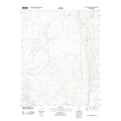
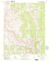
2011 Map of Sullivan Draw North
USGS Topo · Published 2011About this map
Sullivan Draw defines the drainage of this arid Mohave County landscape, where survival and settlement depend entirely on the management of seasonal water. The 2011 survey reveals an intricate network of tanks and small impoundments such as White Rock Tanks and Whiterock Soapstone Reservoir, essential for ranching and wildlife in this high desert region. Transport is limited to rugged tracks like Co HWY 5, which navigates the gap at Wolf Hole Pass. The map highlights several specialized catchment points, including School Section Pond and Thistle Flat Pond, illustrating how water rights and land use are etched into the geography of the Arizona Strip. These features, along with Wolf Hole Valley Pond, mark the isolated outposts of human activity in an otherwise sparsely populated terrain defined by its complex topography and reliance on isolated water sources.
Find a feature on this map
15 named features on this map. Tap any name to fly to it.
Don’t see what you’re looking for? This feature index may not catch every label — zoom into the map to look around manually.
Map Details
Editions of this 2011 Sullivan Draw North Map
This is the sole edition of this map. No revisions or reprints were ever made.
Other maps of this area

1886 · Mt. Trumbull
USGS Topo · 1:250,000

1892 · Mt. Trumbull
USGS Topo · 1:250,000

1953 · Grand Canyon
USGS Topo · 1:250,000

1957 · Grand Canyon
USGS Topo · 1:250,000

1958 · Grand Canyon
USGS Topo · 1:250,000

1960 · Grand Canyon
USGS Topo · 1:250,000
1979 · Sullivan Draw North
USGS Topo · 1:24,000
1979 · Hole-N-Wall
USGS Topo · 1:24,000
1979 · Sullivan Draw South
USGS Topo · 1:24,000
1979 · St. George Canyon
USGS Topo · 1:24,000