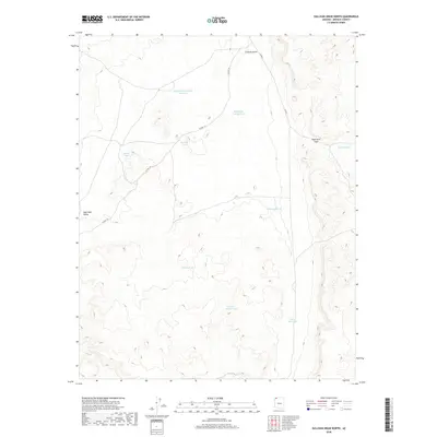
2018 Map of Sullivan Draw North
USGS Topo · Published 2018About this map
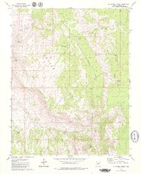
Wolf Hole Valley dominates this high-desert landscape in northern Arizona, providing a stark look at the water-management strategies required for survival in the arid Mohave County interior. The map traces the intermittent course of Sullivan Draw and reveals a network of isolated water sources including Whiterock Soapstone Reservoir and School Section Pond. These features, alongside others like Larson Tank and Sinkhole Pond, emphasize the importance of catchment and storage for local ranching or transit through this remote section of the Arizona Strip. Transportation is defined by the winding paths of Co HWY 101 and Co RD 5, which facilitate movement through the basin and over Wolf Hole Pass. This topographic record illustrates a quiet, sparsely populated territory where geography and hydrology dictate the patterns of human use.
Find a feature on this map
20 named features on this map. Tap any name to fly to it.
Don’t see what you’re looking for? This feature index may not catch every label — zoom into the map to look around manually.
Map Details
Editions of this 2018 Sullivan Draw North Map
This is the sole edition of this map. No revisions or reprints were ever made.
Other maps of this area

1886 · Mt. Trumbull
USGS Topo · 1:250,000

1892 · Mt. Trumbull
USGS Topo · 1:250,000

1953 · Grand Canyon
USGS Topo · 1:250,000

1957 · Grand Canyon
USGS Topo · 1:250,000

1958 · Grand Canyon
USGS Topo · 1:250,000

1960 · Grand Canyon
USGS Topo · 1:250,000
1979 · Sullivan Draw North
USGS Topo · 1:24,000
1979 · Hole-N-Wall
USGS Topo · 1:24,000
1979 · Sullivan Draw South
USGS Topo · 1:24,000
1979 · St. George Canyon
USGS Topo · 1:24,000