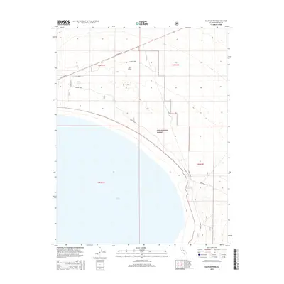
2015 Map of Sulphur Pond
USGS Topo · Published 2015About this map
Mono Lake dominates the southern landscape of this Mono County survey, its vast shoreline framed by the alkaline desert of Mono Valley. The area is defined by its sparse water sources and historical transportation routes, including the prominent Pole Line Rd cutting across the northern reaches. Within the Inyo National Forest boundaries, a network of tracks like the N Shore Access and E Shore Road provide access to remote hydrologic features. Researchers will find interest in the mapping of Walford Springs and the eponymous Sulphur Pond, which reflect the geothermal and mineral-rich character of this high-desert basin. The presence of Warm Springs further illustrates the specific environmental profile of the Eastern Sierra region in the early 21st century.
Find a feature on this map
16 named features on this map. Tap any name to fly to it.
Don’t see what you’re looking for? This feature index may not catch every label — zoom into the map to look around manually.
Map Details
Editions of this 2015 Sulphur Pond Map
This is the sole edition of this map. No revisions or reprints were ever made.
Other maps of this area

1901 · Mt. Lyell
USGS Topo · 1:125,000

1909 · Hawthorne
USGS Topo · 1:250,000

1909 · Bridgeport
USGS Topo · 1:125,000

1911 · Bridgeport
USGS Topo · 1:125,000

1911 · Hawthorne
USGS Topo · 1:250,000

1914 · Mt. Morrison
USGS Topo · 1:125,000

1915 · Hawthorne
USGS Topo · 1:250,000

1920 · Bridgeport
USGS Topo · 1:125,000

1947 · Mariposa
USGS Topo · 1:250,000

1948 · Walker Lake
USGS Topo · 1:250,000