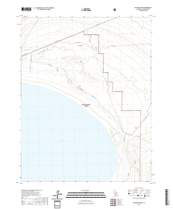
2021 Map of Sulphur Pond
USGS Topo · Published 2021About this map
Mono Lake dominates the southern landscape of this Mono County quadrangle, where the high desert meets the shoreline near the Inyo National Forest boundary. The area is characterized by isolated water sources and primitive transport routes essential for navigating the arid Mono Valley terrain. Notable hydrological features include the namesake Sulphur Pond and the clustered Walford Springs, which provided critical water points in an otherwise unforgiving environment.
Find a feature on this map
15 named features on this map. Tap any name to fly to it.
Don’t see what you’re looking for? This feature index may not catch every label — zoom into the map to look around manually.
Map Details
Editions of this 2021 Sulphur Pond Map
This is the sole edition of this map. No revisions or reprints were ever made.
Other maps of this area

1901 · Mt. Lyell
USGS Topo · 1:125,000

1909 · Hawthorne
USGS Topo · 1:250,000

1909 · Bridgeport
USGS Topo · 1:125,000

1911 · Bridgeport
USGS Topo · 1:125,000

1911 · Hawthorne
USGS Topo · 1:250,000

1914 · Mt. Morrison
USGS Topo · 1:125,000

1915 · Hawthorne
USGS Topo · 1:250,000

1920 · Bridgeport
USGS Topo · 1:125,000

1947 · Mariposa
USGS Topo · 1:250,000

1948 · Walker Lake
USGS Topo · 1:250,000