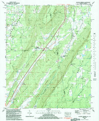
1982 Map of Sulphur Springs
USGS Topo · Published 1983About this map
The Great Southern Railroad follows the base of Lookout Mountain in this 1980s landscape, connecting the small communities of Sulphur Springs Station and Battelle. This corridor along the Alabama-Georgia border is defined by sharp topographic shifts from the heights of Sand Mountain down through the Little River Valley. Local history is anchored by numerous rural congregations and resting places, such as Smith Chapel, Bethlehem Ch, and Bible Cemetery. The geography reveals a tradition of mountain life, with homes and crossroads like Gann Crossroad situated along ridges and gaps. From the industrial remnants of Amos Mill to the natural features of Deer Head Cove and Eagle Cliff, the area maintains a distinct rural character shaped by the drainage of the West Fork Little River and Lookout Creek.
Find a feature on this map
64 named features on this map. Tap any name to fly to it.
Don’t see what you’re looking for? This feature index may not catch every label — zoom into the map to look around manually.
Map Details
Editions of this 1982 Sulphur Springs Map
This is the sole edition of this map. No revisions or reprints were ever made.
Other maps of this area

1886 · Ringgold
USGS Topo · 1:125,000

1886 · Stevenson
USGS Topo · 1:125,000

1892 · Ringgold
USGS Topo · 1:125,000

1892 · Stevenson
USGS Topo · 1:125,000

1895 · Stevenson
USGS Topo · 1:125,000

1935 · Durham
USGS Topo · 1:24,000

1936 · Trenton
USGS Topo · 1:24,000

1936 · Ider
USGS Topo · 1:24,000

1936 · Flat Rock
USGS Topo · 1:24,000

1936 · Dugout Valley
USGS Topo · 1:24,000