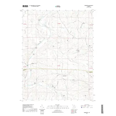
2017 Map of Summerfield
USGS Topo · Published 2017About this map
The Gasconade River winds through this central Missouri landscape, carving a deep corridor defined by prominent landmarks such as Keeney Bluff, Matt Bluff, and Hatchee Bluff. This 2017 study illustrates the rural character of the border between Osage and Maries counties, where the small community of Summerfield serves as a central point for the surrounding agricultural and timbered lands. To the north, the settlement of Koenig and the namesake Koenig Cem reflect the area's ancestral roots, while the isolated landing of Gascondy sits along the river's bend.
Find a feature on this map
90 named features on this map. Tap any name to fly to it.
Don’t see what you’re looking for? This feature index may not catch every label — zoom into the map to look around manually.
Map Details
Editions of this 2017 Summerfield Map
This is the sole edition of this map. No revisions or reprints were ever made.
Other maps of this area

1934 · Linn
USGS Topo · 1:48,000

1934 · Bland
USGS Topo · 1:62,500

1934 · Redbird
USGS Topo · 1:62,500

1937 · Bland
USGS Topo · 1:62,500

1937 · Vienna
USGS Topo · 1:62,500

1938 · Redbird
USGS Topo · 1:62,500

1938 · Vienna
USGS Topo · 1:48,000

1942 · Linn
USGS Topo · 1:62,500

1945 · Linn
USGS Topo · 1:62,500

1949 · Saint Louis
USGS Topo · 1:250,000