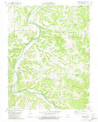
1981 Map of Summerfield
USGS Topo · Published 1981About this map
The Gasconade River meanders deeply through the limestone topography of this mid-Missouri landscape, defining the border between Osage and Maries counties. Steep riverbanks are marked by prominent features like Cave Bluff, Keeney Bluff, and Hatchee Bluff, where the water has carved narrow valleys and expansive bends. Small settlements and family-named landmarks are scattered throughout the upland ridges and hollows, including the community of Summerfield and the remote Koenig area, the latter notable for the Koenig Cemetery and nearby kiln sites.
Find a feature on this map
41 named features on this map. Tap any name to fly to it.
Don’t see what you’re looking for? This feature index may not catch every label — zoom into the map to look around manually.
Map Details
Editions of this 1981 Summerfield Map
This is the sole edition of this map. No revisions or reprints were ever made.
Other maps of this area

1934 · Linn
USGS Topo · 1:48,000

1934 · Bland
USGS Topo · 1:62,500

1934 · Redbird
USGS Topo · 1:62,500

1937 · Bland
USGS Topo · 1:62,500

1937 · Vienna
USGS Topo · 1:62,500

1938 · Redbird
USGS Topo · 1:62,500

1938 · Vienna
USGS Topo · 1:48,000

1942 · Linn
USGS Topo · 1:62,500

1945 · Linn
USGS Topo · 1:62,500

1949 · Saint Louis
USGS Topo · 1:250,000