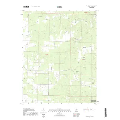
2017 Map of Summersville NE
USGS Topo · Published 2017About this map
Ozark National Scenic Riverways protects the southern reach of this landscape, where the karst topography of Shannon County is on full display. The terrain is defined by an intricate network of drainage systems, including Spring Valley Cr and Casto Valley Cr, which have carved numerous deep hollows into the plateau. Of particular interest to geologists and local historians is the Forty Acre Sinkhole, a massive natural depression that highlights the subterranean drainage patterns of the region.
Find a feature on this map
58 named features on this map. Tap any name to fly to it.
Don’t see what you’re looking for? This feature index may not catch every label — zoom into the map to look around manually.
Map Details
Editions of this 2017 Summersville NE Map
This is the sole edition of this map. No revisions or reprints were ever made.
Other maps of this area

1915 · Eminence
USGS Topo · 1:62,500

1917 · Eminence
USGS Topo · 1:62,500

1932 · Cedar Grove
USGS Topo · 1:48,000

1945 · Round Spring
USGS Topo · 1:62,500

1946 · Summersville
USGS Topo · 1:62,500

1947 · Sinkin
USGS Topo · 1:48,000

1948 · Summersville
USGS Topo · 1:62,500

1949 · Round Spring
USGS Topo · 1:62,500

1949 · Rolla
USGS Topo · 1:250,000
1951 · Lewis Hollow
USGS Topo · 1:24,000