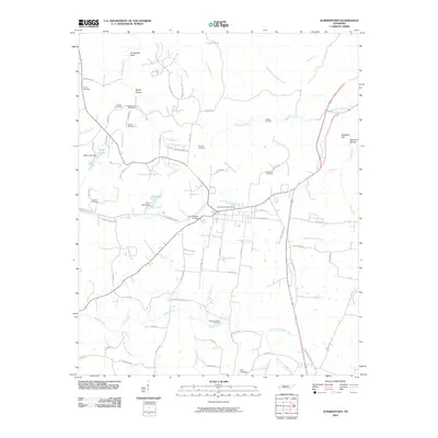
2010 Map of Summertown
USGS Topo · Published 2010About this map
Summertown Post Office serves as the central node for this Lawrence and Lewis County landscape, where the headwaters of several river systems emerge. The terrain is defined by the winding course of the Buffalo River, which flows through the southern portion of the quadrangle, and the North Fork Buffalo River to the east. Transportation history is etched into the land via the distinct diagonal of Railroad Bed Pike and the historic Old Military Rd, which reflect early corridors of trade and movement through Middle Tennessee.
Find a feature on this map
84 named features on this map. Tap any name to fly to it.
Don’t see what you’re looking for? This feature index may not catch every label — zoom into the map to look around manually.
Map Details
Editions of this 2010 Summertown Map
This is the sole edition of this map. No revisions or reprints were ever made.
Other maps of this area

1901 · Colombia
USGS Topo · 1:125,000

1936 · Sandy Hook
USGS Topo · 1:24,000

1936 · Deerfield
USGS Topo · 1:24,000

1936 · Mt Joy
USGS Topo · 1:24,000

1936 · Henryville
USGS Topo · 1:24,000

1936 · Campbellsville
USGS Topo · 1:24,000

1936 · Ethridge
USGS Topo · 1:24,000

1936 · Crestview
USGS Topo · 1:24,000

1936 · Mount Pleasant
USGS Topo · 1:24,000

1936 · Gordonsburg
USGS Topo · 1:24,000