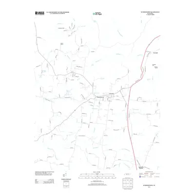
2013 Map of Summertown
USGS Topo · Published 2013About this map
Summertown and the surrounding Lewis County countryside are defined by a complex network of waterways where the Buffalo River begins to take shape. The landscape is characterized by the confluence of the N Fork Buffalo River and S Fork Buffalo River, winding through areas like Wyrick Hollow and past the heights of Rockdale Hill. A distinct grid of numbered roads, including 1st Rd through 5th Rd, suggests a planned agricultural or residential layout in the northern section near Big Swan Cr. This 2013 survey provides a clear view of how rural Tennessee infrastructure integrates with its natural hydrology, from the recreational waters of Miller Lake and Pine Lake to the sharp elevation of Rattlesnake Falls near the settlement of Rockdale. Local landmarks like Carpenter Spring and Kidd Spring highlight the region's reliance on natural spring sources throughout the central uplands.
Find a feature on this map
132 named features on this map. Tap any name to fly to it.
Don’t see what you’re looking for? This feature index may not catch every label — zoom into the map to look around manually.
Map Details
Editions of this 2013 Summertown Map
This is the sole edition of this map. No revisions or reprints were ever made.
Other maps of this area

1901 · Colombia
USGS Topo · 1:125,000

1936 · Sandy Hook
USGS Topo · 1:24,000

1936 · Deerfield
USGS Topo · 1:24,000

1936 · Mt Joy
USGS Topo · 1:24,000

1936 · Henryville
USGS Topo · 1:24,000

1936 · Campbellsville
USGS Topo · 1:24,000

1936 · Ethridge
USGS Topo · 1:24,000

1936 · Crestview
USGS Topo · 1:24,000

1936 · Mount Pleasant
USGS Topo · 1:24,000

1936 · Gordonsburg
USGS Topo · 1:24,000