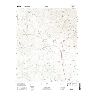
2016 Map of Summertown
USGS Topo · Published 2016About this map
Summertown and the surrounding highlands of the Tennessee Valley Divide are captured here as the landscape transitioned toward modern residential development. This area at the intersection of Lewis, Lawrence, and Maury Counties is defined by the headwaters of several significant drainage systems, including the Buffalo River and Big Bigby Cr. The presence of numerous small family and community burial grounds, such as Himes Cem, Wyrick Cem, and Drakes Lane Cem, reflects a deep-rooted history of rural settlement patterns and local genealogy. Industrial remnants of the region's past are indicated by Rockdale Hill and the presence of the CSX Transportation railroad line, which skirts the eastern edge of the quadrangle. The terrain is deeply dissected by hollows like Ledbetter Hollow and Pickard Hollow, creating a complex network of ridges that shaped the original road layouts, many of which now bear the names of early local families.
Find a feature on this map
136 named features on this map. Tap any name to fly to it.
Don’t see what you’re looking for? This feature index may not catch every label — zoom into the map to look around manually.
Map Details
Editions of this 2016 Summertown Map
This is the sole edition of this map. No revisions or reprints were ever made.
Other maps of this area

1901 · Colombia
USGS Topo · 1:125,000

1936 · Sandy Hook
USGS Topo · 1:24,000

1936 · Deerfield
USGS Topo · 1:24,000

1936 · Mt Joy
USGS Topo · 1:24,000

1936 · Henryville
USGS Topo · 1:24,000

1936 · Campbellsville
USGS Topo · 1:24,000

1936 · Ethridge
USGS Topo · 1:24,000

1936 · Crestview
USGS Topo · 1:24,000

1936 · Mount Pleasant
USGS Topo · 1:24,000

1936 · Gordonsburg
USGS Topo · 1:24,000