
1949 Map of Summit
USGS Topo · Published 1952About this map
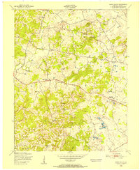
The Nolin River winds in tight, serpentine oxbows through the heart of the region, creating a distinctive landscape of isolated knobs and deep hollows along the Hardin and Grayson County line. Just after the war, the area's social geography is anchored by a network of rural institutions like Oak Ridge School and Meeting Creek Church, reflecting a decentralized community structure. The Illinois Central railroad serves as the primary transportation spine, connecting the settlements of Eastview and Summit across the higher elevations.
Find a feature on this map
43 named features on this map. Tap any name to fly to it.
Don’t see what you’re looking for? This feature index may not catch every label — zoom into the map to look around manually.
Map Details
Editions of this 1949 Summit Map
This is the sole edition of this map. No revisions or reprints were ever made.
Other maps of this area

1925 · Cub Run
USGS Topo · 1:62,500

1932 · Big Clifty
USGS Topo · 1:62,500

1934 · Munfordville
USGS Topo · 1:48,000

1935 · Elizabethtown
USGS Topo · 1:48,000

1937 · Munfordville
USGS Topo · 1:62,500

1938 · Elizabethtown
USGS Topo · 1:62,500

1948 · Cecilia
USGS Topo · 1:24,000

1949 · Sonora
USGS Topo · 1:24,000

1949 · Constantine
USGS Topo · 1:24,000
1949 · Howe Valley
USGS Topo · 1:24,000