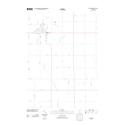
2013 Map of Sumner
USGS Topo · Published 2013About this map
Sumner serves as the central hub of this agricultural landscape, situated at the intersection of State Route 93 and a network of gridded section roads. The town's layout is defined by a dense grid of streets including Wapsie St, Division St, and Oak St, reflecting its growth as a local center for commerce. The Little Wapsipinicon River meanders through the township, crossing beneath the Sumner Bridge and providing the primary drainage for the surrounding fields. The eastern portion of the map is punctuated by the smaller Stoe Creek, which cuts through the farm plots near 110th St. This survey illustrates the persistent importance of section-line roads like Whitetail Ave and Yukon Ave in maintaining the region's rural connectivity and farming infrastructure.
Find a feature on this map
56 named features on this map. Tap any name to fly to it.
Don’t see what you’re looking for? This feature index may not catch every label — zoom into the map to look around manually.
Map Details
Editions of this 2013 Sumner Map
This is the sole edition of this map. No revisions or reprints were ever made.
Other maps of this area

1901 · Oelwein
USGS Topo · 1:125,000

1954 · Waterloo
USGS Topo · 1:250,000

1955 · Waterloo
USGS Topo · 1:250,000

1959 · Dubuque
USGS Topo · 1:250,000

1961 · Dubuque
USGS Topo · 1:250,000

1962 · Dubuque
USGS Topo · 1:250,000

1971 · Readlyn
USGS Topo · 1:24,000

1971 · Sumner
USGS Topo · 1:24,000

1971 · Alpha
USGS Topo · 1:24,000

1971 · Sumner SW
USGS Topo · 1:24,000