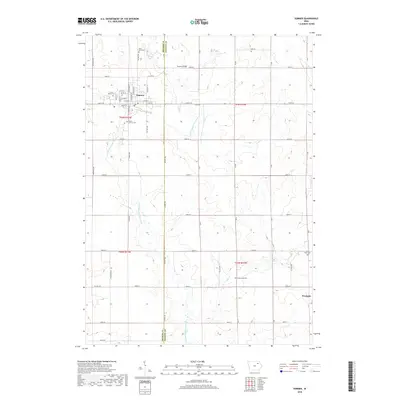
2018 Map of Sumner
USGS Topo · Published 2018About this map
The Little Wapsipinicon River meanders through this agricultural landscape on the border of Bremer and Fayette counties, anchoring the town of Sumner. The community is organized around a grid of streets such as Wapsie St and N Railroad St, reflecting its historical reliance on the rail corridor that once served the local grain and dairy economy. Several cemeteries are scattered throughout the rural sections and town outskirts, including Union Mound Cem, Saint John Cem, and Mount Calvary Cem, providing significant touchpoints for genealogical research in this part of Iowa. To the southeast, the village of Westgate sits near the crossing of 100th St and Willow Rd. This area is characterized by a high density of named country roads and small tributaries like Stoe Cr, which feed the river system beneath the Sumner Bridge.
Find a feature on this map
51 named features on this map. Tap any name to fly to it.
Don’t see what you’re looking for? This feature index may not catch every label — zoom into the map to look around manually.
Map Details
Editions of this 2018 Sumner Map
This is the sole edition of this map. No revisions or reprints were ever made.
Other maps of this area

1901 · Oelwein
USGS Topo · 1:125,000

1954 · Waterloo
USGS Topo · 1:250,000

1955 · Waterloo
USGS Topo · 1:250,000

1959 · Dubuque
USGS Topo · 1:250,000

1961 · Dubuque
USGS Topo · 1:250,000

1962 · Dubuque
USGS Topo · 1:250,000

1971 · Readlyn
USGS Topo · 1:24,000

1971 · Sumner
USGS Topo · 1:24,000

1971 · Alpha
USGS Topo · 1:24,000

1971 · Sumner SW
USGS Topo · 1:24,000