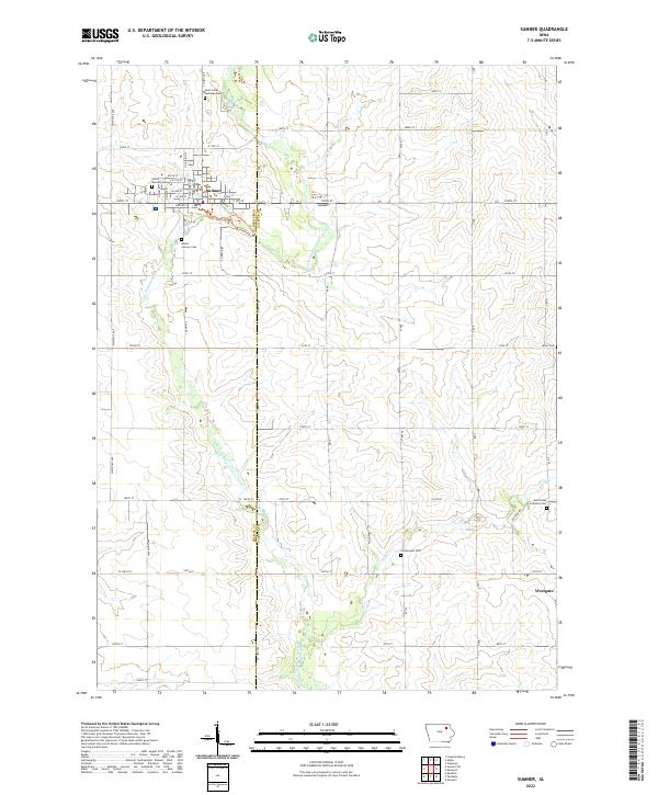
2022 Map of Sumner
USGS Topo · Published 2022About this map
Sumner serves as the primary hub in this corner of Northeast Iowa, situated along the border of Bremer and Fayette counties. The town's grid is anchored by local landmarks such as Union Mound Cem and Mount Calvary Cem, while the surrounding landscape is defined by the meandering path of the Little Wapsipinicon River. To the southeast, the small community of Westgate marks the edge of the survey area, connected by a network of rural roads including County Highway V62. This agricultural region is punctuated by several longstanding spiritual and memorial sites, such as Saint Johns Lutheran Ch and Greenwood Cem. The presence of these cemeteries and churches among the sections of Township 93 North and Township 92 North highlights the deeply rooted settlement patterns that have persisted through generations of farming.
Find a feature on this map
41 named features on this map. Tap any name to fly to it.
Don’t see what you’re looking for? This feature index may not catch every label — zoom into the map to look around manually.
Map Details
Editions of this 2022 Sumner Map
This is the sole edition of this map. No revisions or reprints were ever made.
Other maps of this area

1901 · Oelwein
USGS Topo · 1:125,000

1954 · Waterloo
USGS Topo · 1:250,000

1955 · Waterloo
USGS Topo · 1:250,000

1959 · Dubuque
USGS Topo · 1:250,000

1961 · Dubuque
USGS Topo · 1:250,000

1962 · Dubuque
USGS Topo · 1:250,000

1971 · Readlyn
USGS Topo · 1:24,000

1971 · Sumner
USGS Topo · 1:24,000

1971 · Alpha
USGS Topo · 1:24,000

1971 · Sumner SW
USGS Topo · 1:24,000