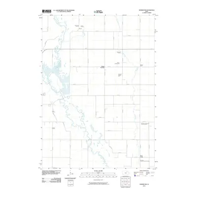
2010 Map of Sumner SW
USGS Topo · Published 2010About this map
The East Fork Wapsipinicon River and its meandering tributaries carve through the rural landscape of Bremer County, Iowa, defining the drainage patterns of this agricultural region. Small settlements like Bremer and Spring Fountain anchor a grid of gravel roads and section lines that have changed little over decades of cultivation. The map reveals a high concentration of denominational landmarks and burial grounds, including the Saint Pauls United Church of Christ Cemetery and the Saint Johns Evangelical Lutheran Cemetery to the south. Aviation history is quietly noted through small private facilities such as the Priebe Landing Field and the Schwerin Landing Strip. These features, alongside family-named landmarks like Wilsons Grove, provide a detailed record of the community's ancestral footprint during the early 21st century.
Find a feature on this map
46 named features on this map. Tap any name to fly to it.
Don’t see what you’re looking for? This feature index may not catch every label — zoom into the map to look around manually.
Map Details
Editions of this 2010 Sumner SW Map
This is the sole edition of this map. No revisions or reprints were ever made.
Other maps of this area

1954 · Waterloo
USGS Topo · 1:250,000

1955 · Waterloo
USGS Topo · 1:250,000

1963 · Denver
USGS Topo · 1:24,000

1971 · Readlyn
USGS Topo · 1:24,000

1971 · Sumner
USGS Topo · 1:24,000

1971 · Alpha
USGS Topo · 1:24,000

1971 · Sumner SW
USGS Topo · 1:24,000

1971 · Fredericksburg
USGS Topo · 1:24,000

1971 · Frederika
USGS Topo · 1:24,000

1971 · Fairbank
USGS Topo · 1:24,000