
1963 Map of Denver
USGS Topo · Published 1964About this map
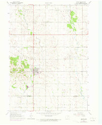
The agricultural landscape of Bremer and Black Hawk Counties unfolds here in the early 1960s, centered on the growing community of Denver. The town sits at a transit crossroads, characterized by the Chicago Great Western railroad line passing through the heart of the region. Local history is deeply rooted in the surrounding townships, including Maxfield, Jefferson, and Mount Vernon, where numerous small cemeteries like Fairview Cem and Jefferson Cem serve as vital markers for genealogical research. The drainage patterns of Quarter Section Run and Crane Creek dictate the local topography, while the presence of an Artesian well and several Gravel Pits point to the area's natural resource utilization during this era. A noteworthy remnant of earlier infrastructure is visible in the Old Railroad Grade, which highlights how the transportation network evolved as the region modernized.
Find a feature on this map
24 named features on this map. Tap any name to fly to it.
Don’t see what you’re looking for? This feature index may not catch every label — zoom into the map to look around manually.
Map Details
Editions of this 1963 Denver Map
2 editions found
Other maps of this area

1954 · Waterloo
USGS Topo · 1:250,000

1955 · Waterloo
USGS Topo · 1:250,000

1963 · Waverly
USGS Topo · 1:24,000

1963 · Cedar Falls
USGS Topo · 1:24,000

1963 · Waterloo North
USGS Topo · 1:24,000

1971 · Readlyn
USGS Topo · 1:24,000

1971 · Bremer
USGS Topo · 1:24,000

1971 · Sumner SW
USGS Topo · 1:24,000

1971 · Dunkerton
USGS Topo · 1:24,000

1971 · Tripoli
USGS Topo · 1:24,000