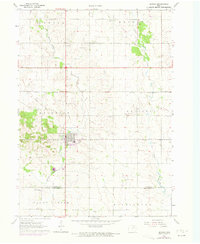
1963 Map of Denver
USGS Topo · Published 1973About this map
Denver serves as the central hub of this Iowa landscape, straddling the border between Bremer Co and Black Hawk Co during the early 1960s. The town's grid is bounded by the Chicago and North Western tracks to the north and an Old Railroad Grade to the south, illustrating the changing transportation priorities of the era. The rural surroundings are densely marked with markers of community life, including Jefferson Cem, St Pauls Cem, and Pioneer Cem, alongside several local congregations like St Pauls Ch and East Janesville Ch. The terrain is defined by the winding paths of Quarter Section Run and Crane Creek, which cut through the agricultural townships of Warren, Jefferson, and Maxfield. Industrial activity is evident through numerous Gravel Pits and a Sandpit scattered across the countryside, reflecting the local resource extraction supporting the region's growth.
Find a feature on this map
24 named features on this map. Tap any name to fly to it.
Don’t see what you’re looking for? This feature index may not catch every label — zoom into the map to look around manually.
Map Details
Editions of this 1963 Denver Map
2 editions found
Other maps of this area

1954 · Waterloo
USGS Topo · 1:250,000

1955 · Waterloo
USGS Topo · 1:250,000

1963 · Waverly
USGS Topo · 1:24,000

1963 · Denver
USGS Topo · 1:24,000

1963 · Cedar Falls
USGS Topo · 1:24,000

1963 · Waterloo North
USGS Topo · 1:24,000

1971 · Readlyn
USGS Topo · 1:24,000

1971 · Bremer
USGS Topo · 1:24,000

1971 · Sumner SW
USGS Topo · 1:24,000

1971 · Dunkerton
USGS Topo · 1:24,000