
1966 Map of Sunbeam
USGS Topo · Published 1968About this map
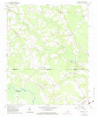
Newsoms and Sands anchor the northern landscape of this Tidewater-area survey, where the winding course of Darden Mill Run dictates the local geography. The map captures a mid-1960s rural network defined by community-centered landmarks such as Mt Horeb Ch, Sunbeam Ch, and Hunts Ch, reflecting the deep-rooted social structure of Southampton and Hertford counties. To the south, the Meherrin River forms a wide natural boundary near Maneys Neck, while the Windbourne Millpond suggests the area's historical reliance on water-powered industry. The transition from Virginia into North Carolina is marked by scattered settlements like Statesville and Britts Store, and specialized features like the Martin Airstrip and numerous Gravel Pit locations reveal the area's diverse mid-century land use. This survey provides genealogists and historians with a clear view of familial and spiritual hubs, including the Hollywood Cem and the remote Buckhorn Ch near the state line.
Find a feature on this map
31 named features on this map. Tap any name to fly to it.
Don’t see what you’re looking for? This feature index may not catch every label — zoom into the map to look around manually.
Map Details
Editions of this 1966 Sunbeam Map
2 editions found
Other maps of this area

1908 · Winton
USGS Topo · 1:62,500

1919 · Boykins
USGS Topo · 1:48,000

1920 · Holland
USGS Topo · 1:62,500

1920 · Boykins
USGS Topo · 1:62,500

1943 · Holland
USGS Topo · 1:62,500

1953 · Norfolk
USGS Topo · 1:250,000

1957 · Holland
USGS Topo · 1:62,500
1966 · Capron
USGS Topo · 1:24,000
1966 · Boykins
USGS Topo · 1:24,000
1967 · Courtland
USGS Topo · 1:24,000