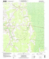
1997 Map of Sunbury
USGS Topo · Published 2000About this map
The western margin of the Great Dismal Swamp dominates this Gates County landscape, where the flat, water-heavy terrain of northeastern North Carolina dictated centuries of settlement patterns. Small communities like Sunbury and Acorn Hill occupy the slightly elevated grounds bordering the swamp, connected by roads that skirt the wetlands. The presence of an Old Railroad Grade running north-south through the center of the sheet speaks to a bygone era of timber extraction or freight transit that once moved through these woods.
Find a feature on this map
16 named features on this map. Tap any name to fly to it.
Don’t see what you’re looking for? This feature index may not catch every label — zoom into the map to look around manually.
Map Details
Editions of this 1997 Sunbury Map
This is the sole edition of this map. No revisions or reprints were ever made.
Other maps of this area

1906 · Beckford
USGS Topo · 1:48,000

1907 · Beckford
USGS Topo · 1:62,500

1919 · Suffolk
USGS Topo · 1:62,500

1940 · Beckford
USGS Topo · 1:62,500

1940 · Lake Drummond
USGS Topo · 1:62,500

1940 · South Mills
USGS Topo · 1:62,500

1945 · Lake Drummond
USGS Topo · 1:62,500

1952 · South Mills
USGS Topo · 1:62,500

1953 · Norfolk
USGS Topo · 1:250,000

1954 · Corapeake
USGS Topo · 1:24,000