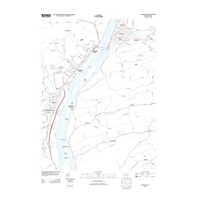
2013 Map of Sunbury
USGS Topo · Published 2013About this map
The Susquehanna River dominates this central Pennsylvania landscape, punctuated by a dense string of islands including Byers Island, Cherry Island, and Kinney Island. On the western bank, the borough of Selinsgrove and the community of Shamokin Dam serve as historical anchors for the region's development along the river valley. The topography reveals a complex network of small settlements such as Hummels Wharf, Dogtown, and Selinsgrove Junction, where the land begins to rise into Jews Hollow.
Find a feature on this map
42 named features on this map. Tap any name to fly to it.
Don’t see what you’re looking for? This feature index may not catch every label — zoom into the map to look around manually.
Map Details
Editions of this 2013 Sunbury Map
This is the sole edition of this map. No revisions or reprints were ever made.
Other maps of this area

1892 · Lykens
USGS Topo · 1:62,500

1892 · Shamokin
USGS Topo · 1:62,500

1893 · Sunbury
USGS Topo · 1:62,500

1893 · Lykens
USGS Topo · 1:62,500

1893 · Shamokin
USGS Topo · 1:62,500

1893 · Millersburg
USGS Topo · 1:62,500

1943 · Millersburg
USGS Topo · 1:62,500

1943 · Lykens
USGS Topo · 1:62,500

1943 · Shamokin
USGS Topo · 1:62,500

1943 · Sunbury
USGS Topo · 1:62,500